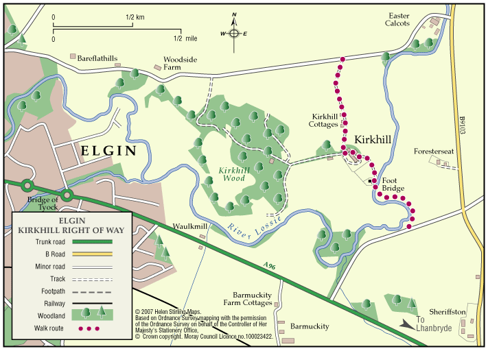
Elgin – Kirkhill Right of Way
The Kirkhill path is part undulating earth surface and part tar road surface which is well used by local fisherman and runs for part of its length alongside the River Lossie.
- Low Level Walk
- Easy
- 1 miles (1.6 km)
- 30 minutes
- Elgin
Terrain: Varied surfaces
Part tarmac and earth path. Earth path section (prone to flooding and muddy when wet) has livestock grazing on occasions.
- Generally level
- Fully signed
Report a route change
If you have followed this route and noticed any differences please report a route change by sending an email to:
Send us a GPX track
We would like to offer GPS tracks of all routes on this site.
If you are able to help please create a GPX track of this route (no detours) and send it to us for inclusion.
Starting at the southern end the route goes through open fields where livestock may be grazing. It crosses over the Lossie by way of a narrow bridge near to the St Andrews Church burial site steeped in local history.
Passing on through Kirkhill Farm, keeping to the waymarkers as you go, the path emerges onto a tarred farm lane and comes out to the Calcots Road. This is an interesting walk with a variety of wildlife to be seen and if you are quiet, possibly catch a glimpse of an otter or heron waiting to plunder the odd fish.
The River holds brown trout, sea trout and salmon and a fishing permit can be obtained locally.