Tiendland Trails
Teindland is a large forest south-east of Elgin with an extensive network of roads and tracks that can be explored.
- Horse Ride
- 8 miles (12.8 km)
Report a route change
If you have followed this route and noticed any differences please report a route change by sending an email to:
Send us a GPX track
We would like to offer GPS tracks of all routes on this site.
If you are able to help please create a GPX track of this route (no detours) and send it to us for inclusion.
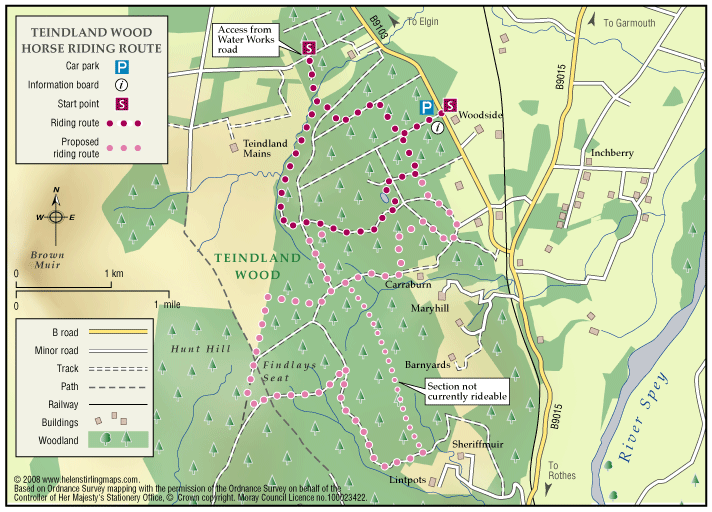
Short Trail – Four miles. Follow the waymarkers – the route is designed to be ridden anti-clockwise.
A longer trail – Eight miles, with an optional loop of three miles, is proposed for future development. Much of this is currently rideable and is shown in pale pink dots on the attached map. The forest has an extensive network of other tracks and forest roads that can be explored – the main ones are shown on the map. An Ordnance Survey map and compass would be useful for longer explorations.
Parking area just off the B9103 Orton (Mulben) – Elgin road, signposted.
Access also on horseback from the Waterworks road at the north end of the forest at Grid Reference NJ287570.
Contact
Forestry and Land Scotland – Huntly Office
- Tel: 0300 067 6380
- Portsoy Road, Huntly AB54 4SH
- Email: enquiries.east@forestryandland.gov.scot