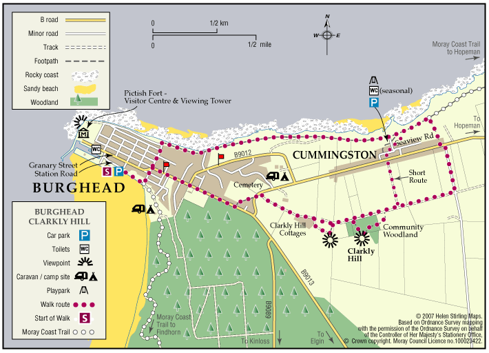
Burghead – Clarkly Hill Circular
A circular walk starting in the Pictish Fort town of Burghead and passing through farmland and rocky shores, with stunning views of the Moray Firth along the ridge of Clarkly Hill.
- Low Level Walk
- Moderate
- 3.5 miles (5.6 km)
- 1h 45 minutes
- Burghead
- Unsuitable for wheelchairs and buggies
Terrain: Varied surfaces
Tarred pavements & roads, gravel paths, and earth/grass paths along the Clarkly Hill sections. Note: the earth paths are rough and uneven in places and can be muddy.
Gradient: Generally level
A gentle slope rising from the Burghead - Lossiemouth road to Clarkly Hill
- Fully signed
Report a route change
If you have followed this route and noticed any differences please report a route change by sending an email to:
Send us a GPX track
We would like to offer GPS tracks of all routes on this site.
If you are able to help please create a GPX track of this route (no detours) and send it to us for inclusion.
Start – Burghead Harbour car park.
The Route: A circular route in either direction, following the signs featuring the yellow bull logo.
The route explores a variety of landscapes, including raised farmland and coastal scenery. The view from the top of Clarkly Hill is a spectacular vista over the Moray Firth, where on a clear day you can see distant Caithness.
Part of the route links Cummingston to Burghead along the old railway.