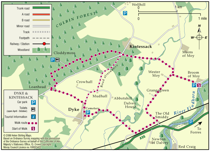
Forres – Dyke & Kintessack Circular
A circular route linking the rural communities of Dyke and Kintessack, with a spur to Broom of Moy, and on to the wider network of paths around Forres.
- Low Level Walk
- Moderate
- 6.5 miles (10.4 km)
- 3 hour(s)
- Broom of Moy, Dyke, Kintessack
- Unsuitable for wheelchairs and buggies
Terrain: Varied surfaces
Minor tarmac roads, forest tracks, earth paths, and short sections of gravel paths. NOTE: In the winter a short section of the path between Dyke and Culbin Forest (at Loanhead) can be very wet. Waterproof boots or wellingtons are advised.
- Generally level
- Fully signed
Report a route change
If you have followed this route and noticed any differences please report a route change by sending an email to:
Send us a GPX track
We would like to offer GPS tracks of all routes on this site.
If you are able to help please create a GPX track of this route (no detours) and send it to us for inclusion.
Start – Dyke Community Hall Car Park.
Signing: The route is marked with timber finger posts and waymarkers with LIGHT BLUE arrows.
A signed shortcut is available that links Dyke and Kintessack directly along the minor road, allowing users the option of two shorter loops.