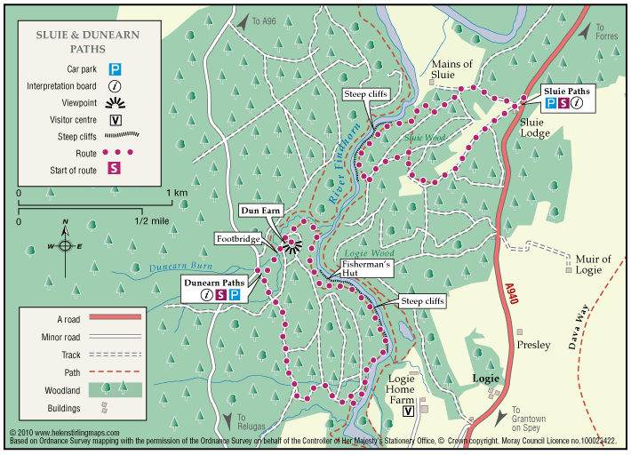
Logie – Dunearn Path
Dunearn path is in the Darnaway Forest and is about one mile south of Conicavel village, it is a circular route, part of which follows close to the River Findhorn. Be aware, the path in sections is very close to the edge of steep drops down to the river.
- Low Level Walk
- Easy
- 2.5 miles (4 km)
- 1h 30 minutes
- Logie
Accessibility: Suitable for a wide range of users
The route is suitable for a wide range of users but the terrain might prove difficult for the less able.
Terrain: Forest tracks
A mixture of woodland earth, aggregate and forest vehicle track. The path can be very wet and muddy in places, in winter time small sections of the path can be covered with leaves so making it very slippy.
- Fully signed
Report a route change
If you have followed this route and noticed any differences please report a route change by sending an email to:
Send us a GPX track
We would like to offer GPS tracks of all routes on this site.
If you are able to help please create a GPX track of this route (no detours) and send it to us for inclusion.
Dunearn path has a small gravel car park and interpretation board at the start, it has two routes which are colour marked on waymarkers.
The path has various scenic views along its length of the river and also a viewpoint. There is a variety of wildlife to be seen and many varieties of trees and plant life to observe.The colours reflecting the time and season of the year.