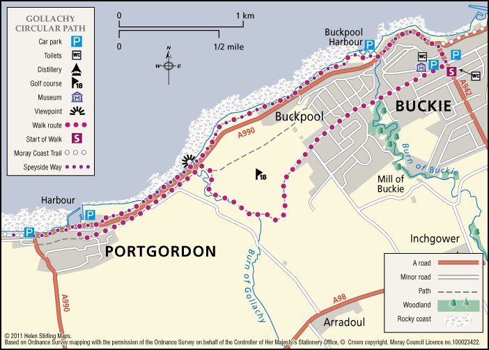
Buckie – Gollachy Circular
This route explores the coast west of Buckie as far as the village of Portgordon, returning at a higher level with extensive views over the Moray Firth.
- Accessible Walk, Low Level Walk
- Moderate
- 5 miles (8 km)
- 2 hour(s)
- Buckie, Portgordon
- Accessible for all users
Terrain: Varied surfaces
Tarred pavements and gravel paths. A short section of earth path at Gollachy Burn can be muddy.
Gradient: Short steep sections
Short steep section climbing up to the golf course near the Gollachy Burn
- Fully signed
Report a route change
If you have followed this route and noticed any differences please report a route change by sending an email to:
Send us a GPX track
We would like to offer GPS tracks of all routes on this site.
If you are able to help please create a GPX track of this route (no detours) and send it to us for inclusion.
Starts and finishes in the square in Buckie.
Follow the northern terminus of the Speyside Way to Buckpool Harbour, and then follow this route to Portgordon. Look out for seals along the foreshore.At Portgordon harbour turn left up to the fingerpost and return by the old railway line as far as the Gollachy Burn, then skirt the Buckpool golf course back to Buckie.
Follow the metal and timber signs with the green Buckie Footpaths Network logo.
The path leading to Crannoch Hill Woods provides panoramic views across Cullen Bay to the hills of Caithness and Sutherland over sixty miles away.