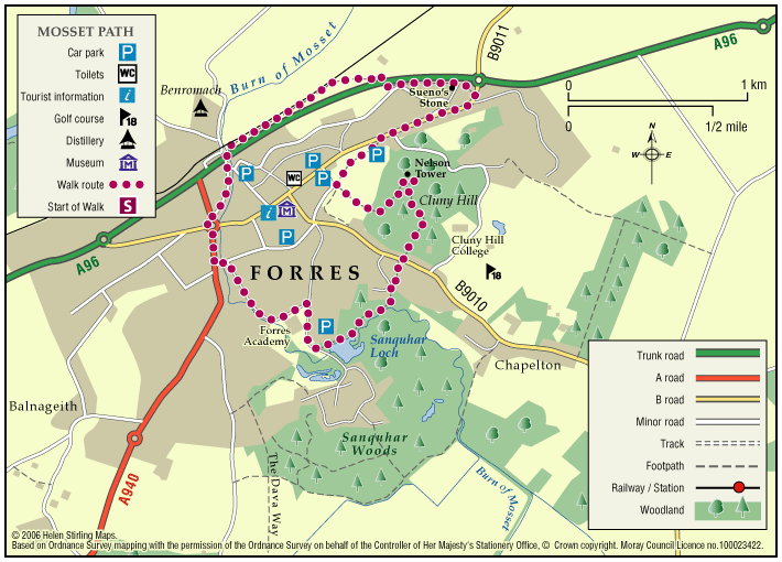
Forres – Mosset Walk
A circular walk around Forres, taking in the picturesque Sanquhar Loch, the panoramic view from the Nelson Tower at the top of Cluny Hill and a fine view of the town from Councillor’s Walk.
- Low Level Walk
- Moderate
- 4 miles (6.4 km)
- 3 hour(s)
- Forres
- Unsuitable for wheelchairs and buggies
Terrain: Paved footpaths & roads
Take care on the two A96 road crossings.
Gradient: Short steep sections
A fairly steep path within Grant Park leading up to Nelson Tower. Otherwise, generally level with only a few gentle slopes.
- Fully signed
Report a route change
If you have followed this route and noticed any differences please report a route change by sending an email to:
Send us a GPX track
We would like to offer GPS tracks of all routes on this site.
If you are able to help please create a GPX track of this route (no detours) and send it to us for inclusion.
Start: Grant Park Car Park on Victoria Road.
Signing: The route is signed with GREEN ARROWS in an anti clockwise direction. Follow the Forres Footpaths Trust signs located on lamp posts, way-markers and occasionally fence posts.
You will pass the following landmarks along the route: Witches’ Stone, Sueno’s stone, Benromach Distillery, Mosset Burn, Sanquar Loch, Nelson’s Tower, and Grant Park.