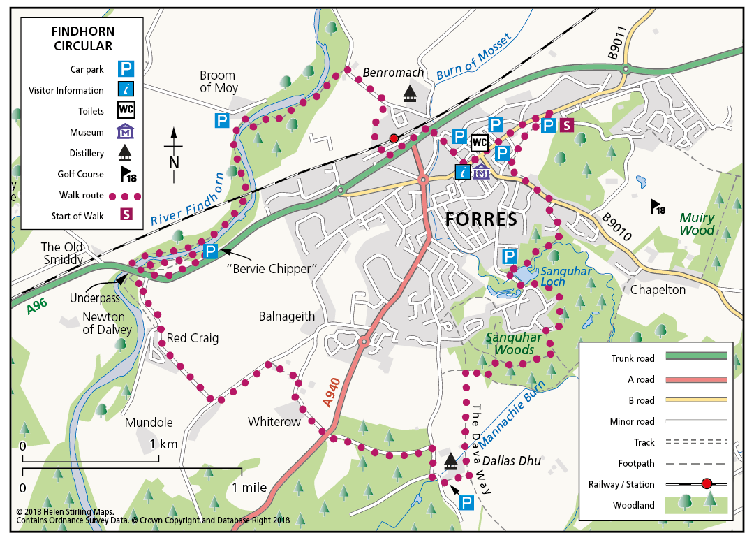
Forres – River Findhorn Circular
A circular walk through and around the town of Forres, following the banks of the River Findhorn for much of the route. With some fine views of the surrounding countryside it explores some attractive, yet less frequented, environs of this pretty Moray town.
- Low Level Walk
- Moderate
- 8 miles (12.8 km)
- 5 hour(s)
- Broom of Moy, Forres
Accessibility: Unsuitable for wheelchairs and buggies
Suitable for most abilities of walker, but the length of the walk and the steps may restrict access some users.
Terrain: Varied surfaces
Mainly tarmac paths and pavements, quiet country road, and gravel tracks. There are a few sections of earth paths through the woodland and along the river. The route along the river goes under the A96 bridge, where great care should be taken if the river is in spate. Also take care at the A96 road crossing.
Gradient: Generally level
Relatively level with only a few gentle gradients.
- Fully signed
Report a route change
If you have followed this route and noticed any differences please report a route change by sending an email to:
Start Point: Grant Park Car Park on Victoria Road.
Signing: This walk is waymarked with PURPLE arrows on lampposts, waymarkers and, occasionally, fencing.
The route is signed in a clockwise direction.
Land marks and places of interest along the way: Grant Park, Sanquhar Loch, Sanquhar Wood, Dallas Dhu Distillery, River Findhorn, the Findhorn Bridge, the Bailey Bridge, Mosset Burn Benromach Distillery, Forres High Street.