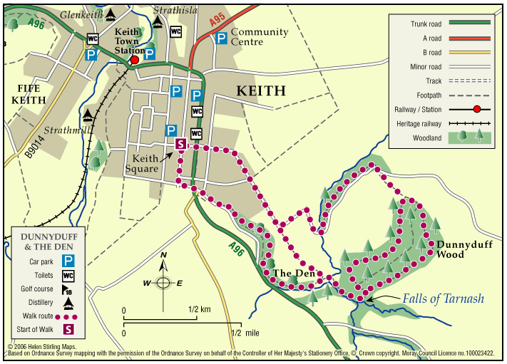
Keith – Dunnyduff and The Den
This walk is part of a network of waymarked and signed paths linking all the delights the Keith area has to offer. The route can be enjoyed in both directions, starting and finishing at the map information board in Keith Square (Reidhaven Square).
- Low Level Walk
- Moderate
- 3 miles (4.8 km)
- 2 hour(s)
- Keith
Accessibility: Unsuitable for wheelchairs and buggies
Suitable for a wide range of users in the flat sections near Keith but in the countryside the route is appropriate for more able, energetic persons. Horse riding is not recommended at Tarnash due to the steep nature of the path linking to Dunnyduff.
Terrain: Varied surfaces
A combination of roadside pavements, minor roads, green tracks and some rougher paths with several steep inclines.
- Short steep sections
- Fully signed
Report a route change
If you have followed this route and noticed any differences please report a route change by sending an email to:
Send us a GPX track
We would like to offer GPS tracks of all routes on this site.
If you are able to help please create a GPX track of this route (no detours) and send it to us for inclusion.
The route is a must for the nature lover, involving a variety of paths linking Keith and the tree lined Den with the beautiful falls of Tarnash and Dunnyduff Wood managed by the Forestry & Land Scotland.
As parts of the route cross open countryside and have a variety of path surfaces, stout footwear and waterproof clothing are recommended.
Contact
Moray Council Outdoor Access Manager
- Hector Bryden
- E-mail: morayaccess@moray.gov.uk
Contact
Forestry and Land Scotland – Huntly Office
- Tel: 0300 067 6380
- Portsoy Road, Huntly AB54 4SH
- Email: enquiries.east@forestryandland.gov.scot

