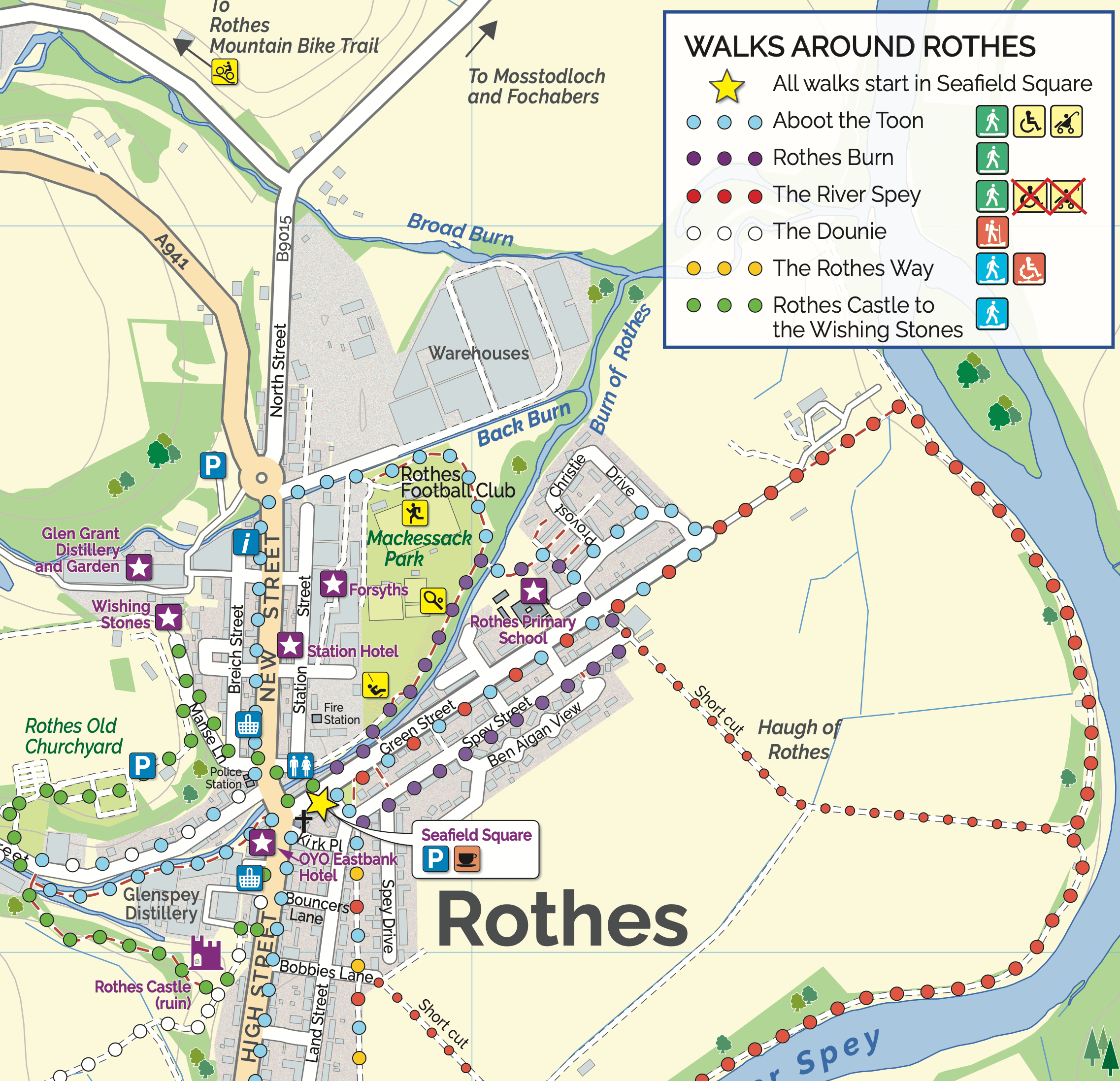
Rothes – The Dounie
This walk follows the Rothes Burn upstream to the Giant’s Table and the Fairy Rock – volcanic outcrops worn and shaped by thousands of years of erosion – and returns by the track skirting the golf course.
- Hill Walk, Low Level Walk, Walking Routes
- Moderate
- 4.8 miles (7.68 km)
- 1h 30 minutes
- Rothes
- Unsuitable for wheelchairs and buggies
Terrain: Varied surfaces
Mostly Forest tracks. If you decend via the golf course then the route is by road.
Gradient: Short steep sections
Varying gradients, climbing to 250m.
- Partly signed
Report a route change
If you have followed this route and noticed any differences please report a route change by sending an email to:
Send us a GPX track
We would like to offer GPS tracks of all routes on this site.
If you are able to help please create a GPX track of this route (no detours) and send it to us for inclusion.
This walk follows the Rothes Burn upstream to the Giant’s Table and the Fairy Rocks – volcanic outcrops worn and shaped by thousands of years of erosion – and returns by a track skirting the golf course and passing Rothes Castle and a lavender field.
Rothes Rambles
The Rothes Rambles leaflet is a wonderful celebration of local creativity by the talented pupils of Rothes Primary School with support from Norma D Hunter, the 2023/24 AIM (Arts in Moray) Artist in Residence for the Moray Way. Through sound, colour, storytelling and images, Norma inspired the pupils to explore and interpret each walk in their own way. Make sure to look out for their place markers on each walk!
 Pupils’ View: A long time ago in a friendly town called Rothes, there lived a great, gentle giant.

Find other walks in the Rothes Rambles leaflet:
Download Rothes Rambles here.
The Rothes Rambles project is one of many projects from AIM, (Arts In Moray) a Culture Collective initiative funded by the Scottish Government through Creative Scotland. AIM is a Moray-based collaboration between Dance North Scotland, M:ADE, Wildbird, and The Moray Way Association, supporting community-led creativity and connection across the region.