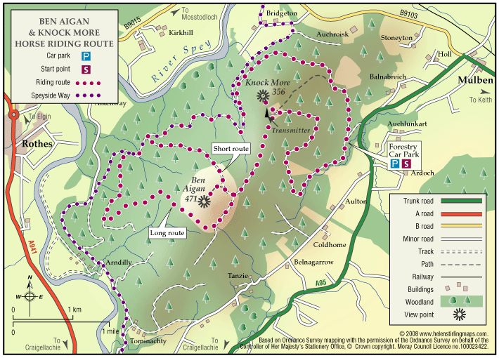
Ben Aigan

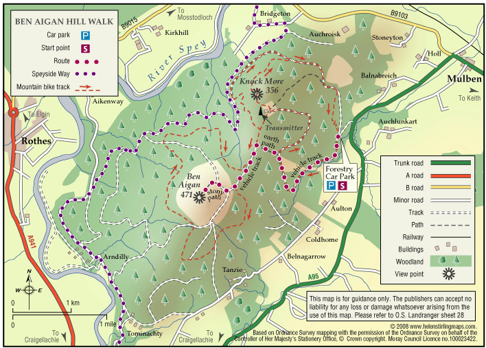
Ben Aigan lies to the east of Rothes, the north east of Craigellachie and to the east of the River Spey which flows along the foot of its western and northern slopes. Rising to a height of 471m (1546 feet) and extensively forested apart from the summit cone, the top of Ben Aigan provides magnificent views over Speyside, south to Ben Rinnes, and away to the north over the Moray Firth to the hills of Sutherland

  • Unsuitable for wheelchairs and buggies
  • Defined hill path
  • Slopes throughout
  • Partly signed

Ben Aigan and Knockmore

This ride takes you to the transmitter on Knockmore, the summit of Ben Aigan and stunning views of Speyside. The route described is not way-marked by the Forestry Commission as a horse-riding trail.

  • Terrain: Varied surfaces

    Mostly forest roads, some open moorland and one steep grassy track. The climb to the summit is very stony.

  • Mixed gradient

Rothes – Burn Walk

This flat, circular walk follows the Rothes Burn as it passes through the Playing Fields and also includes some great views over the open countryside to Ben Aigen. The surfaces are all good and are suitable for wheelchairs and buggies, although care is needed over the footbridges.

  • Accessible for all users
  • Paved footpaths & roads
  • Generally level
  • Barriers: No barriers

    Take care crossing the footbridges.

Rothes – Spey Walk

This flat, circular walk follows the River Spey on it’s way from Craigellachie to Boat o’ Brig. The path is good but is not suitable for wheelchairs or buggies. The scenery along this walk is very beautiful at any time of year, although it can be a little exposed in places and the paths can be muddy in wet weather.

  • Unsuitable for wheelchairs and buggies
  • Terrain: Varied surfaces

    Mainly grass and earth path, with some sections of farm track and tarmac. Paths can be muddy when wet.

  • Generally level

Rothes – The Dounie

This walk follows the Rothes Burn upstream to the Giant’s Table and the Fairy Rock – volcanic outcrops worn and shaped by thousands of years of erosion – and returns by the track skirting the golf course.

  • Suitable for a wide range of users
  • Varied surfaces
  • Gradient: Mixed gradient

    Varying gradients, climbing to 250m.

  • Barriers: Some barriers

    Some steps

  • Fully signed