Moray Coastal Cycle Route
This is a signed cycle route from Burghead to Cullen, linking the coastal communities. Explore the dramatic landscapes from rugged cliffs to sweeping shores, sheltered coves to fishertown harbours. Visitors are drawn by the resident bottlenose dolphins and the myriad of birdlife on the cliffs.
- Cycle Route
- 29 miles (46.4 km)
- Buckie, Burghead, Elgin, Findochty, Garmouth, Hopeman, Lossiemouth, Portgordon, Portknockie, Spey Bay
Accessibility: Suitable for a wide range of users
Suitable for all types of bikes. Some sections are suitable for walking and horse riding.
Terrain: Paved footpaths & roads
Good surfacing through out, combining a mixture of gravel paths, tarmac paths, and public road sections.
- Generally level
- Fully signed
Report a route change
If you have followed this route and noticed any differences please report a route change by sending an email to:
Send us a GPX track
We would like to offer GPS tracks of all routes on this site.
If you are able to help please create a GPX track of this route (no detours) and send it to us for inclusion.
Gallery

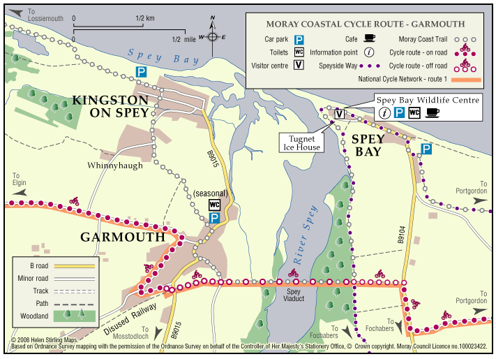

Please note that the Spey Viaduct Bridge is closed – we are currently updating all routes affected by this closure.
Moray Council have suggested the following: The viaduct connecting the Speyside Way and the village of Garmouth is closed, with the nearest alternative crossing of the river Spey located at Fochabers, approximately 3 miles upstream. This can be reached via the Speyside Way on the east side of the river. On the west side of the river, there is no pedestrian path connecting Fochabers to Garmouth. A quiet, unclassified road is available, but it should be used with care due to the limited verge. The river can be crossed at Fochabers either via the old road bridge, which is now for pedestrians only, or via the pavement alongside the A96 road bridge. (Please take care when crossing public roads)
Get on you bike and ride the route or why not rest a while and explore the area’s history, culture and the world famous whisky trail.
The route links the main towns of Moray’s Coast and makes the most of the open views across the Moray Firth, famous for dolphins. Much of the coastline is wild and unspoilt and displays a wide variety of animal and plant life.
Moray’s historic sea towns which are all visited by the route are unique in their rich built heritage founded on the fishing industry. Further information on local settlements and their attractions can be found on the information boards along the cycle route.
Look out for the dolphin logo, and the information boards along the route.
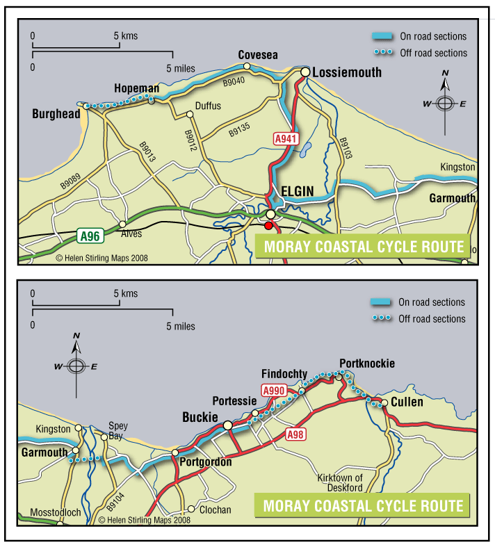
- Map 1 – Burghead to Hopeman
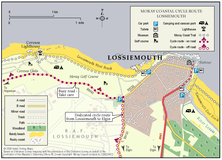
- Map 2 – Lossiemouth
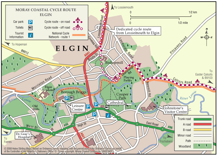
- Map 3 – Elgin
- Map 4 – Garmouth
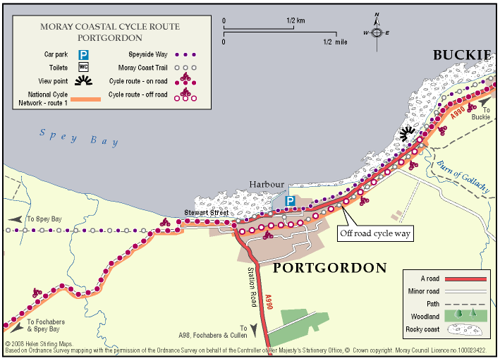
- Map 5 – Portgordon
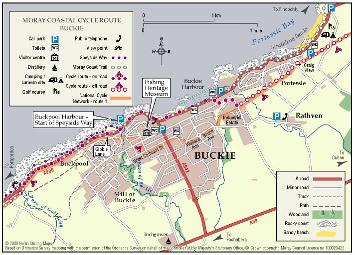
- Map 6 – Buckie
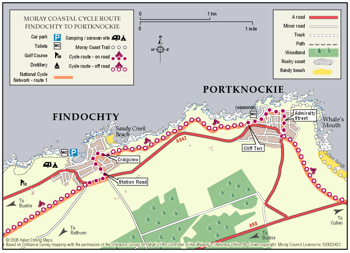
- Map 7 – Findochty to Portknockie
- Map 8 – Cullen
When using on-road sections, care to be taken due to the presence of fast moving vehicular traffic. This is particularly so between Hopeman and Lossiemouth.