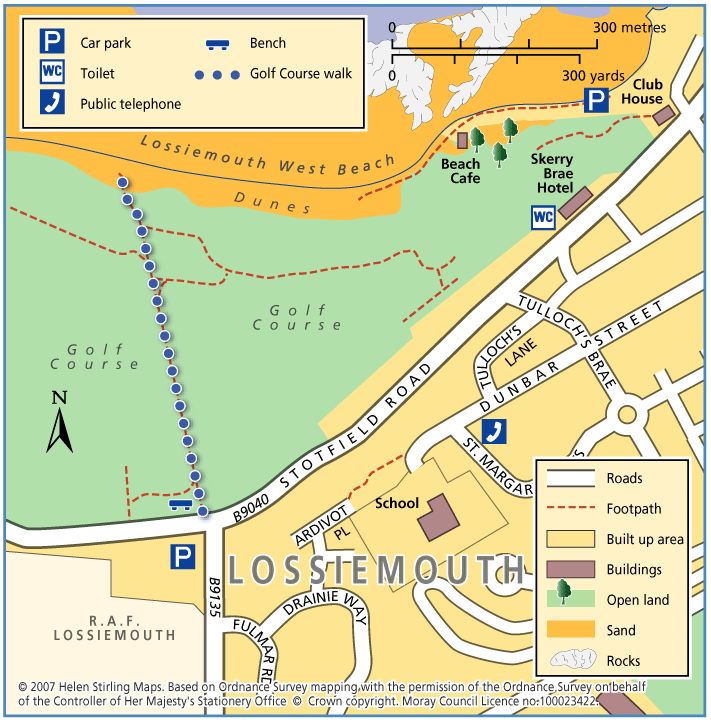
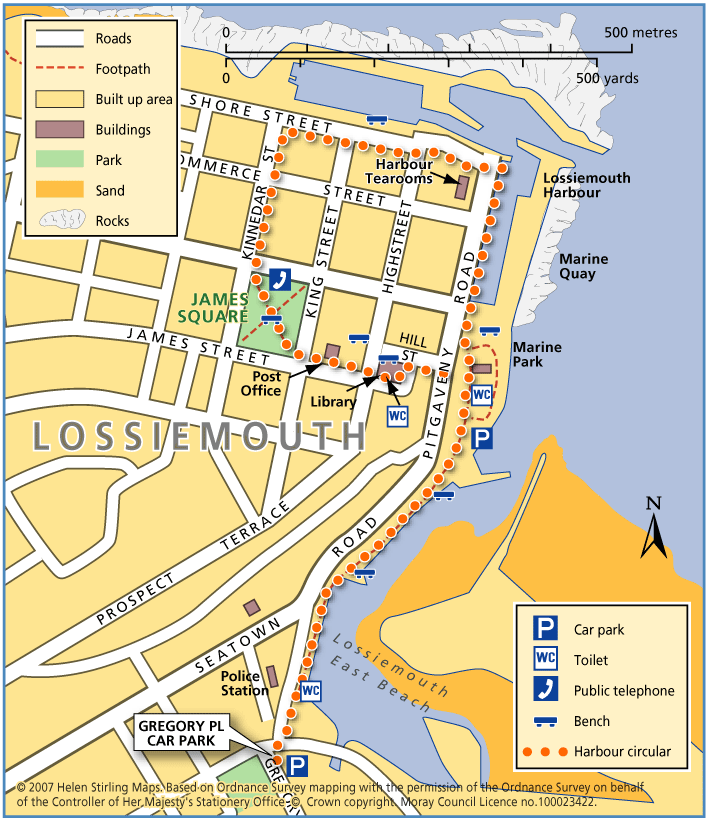
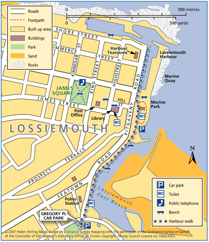
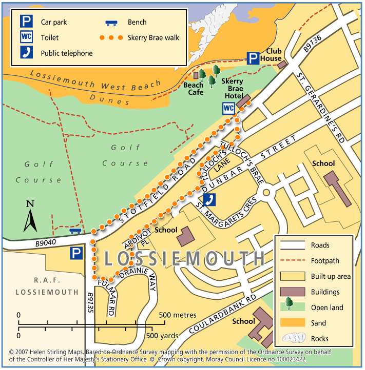
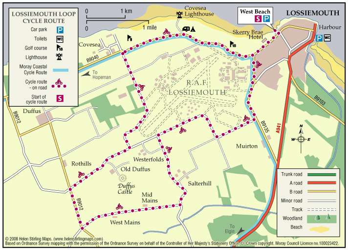
Lossiemouth – Forest by the Firth Trail 

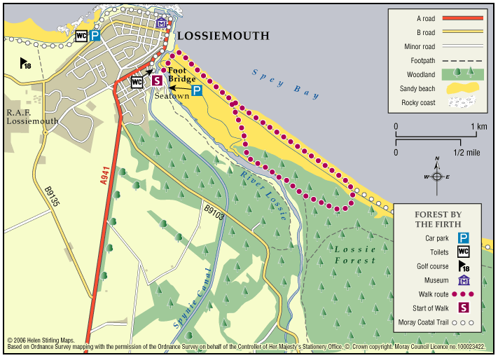
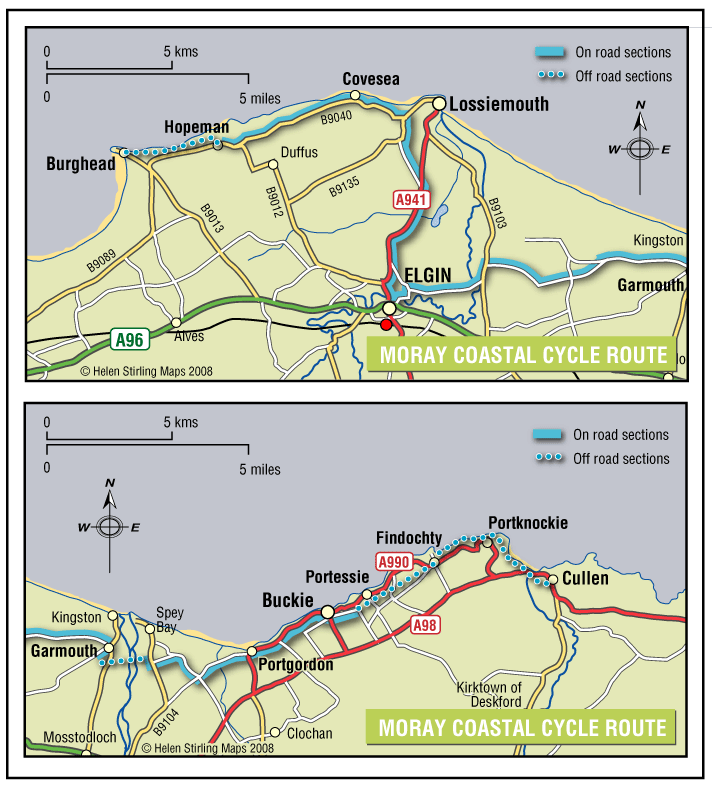
The town commands the prominent headland at the mouth of the River Lossie. It has dramatic and beautiful beaches, wonderful countryside and plenty to see and do. Part of the route follows the long-distance Moray Coast Trail. 

  • Accessibility: Unsuitable for wheelchairs and buggies

    Due to the loose sand and shingle, the route is unsuitable for wheelchairs, buggies or road bikes.

  • Terrain: Varied surfaces

    The route follows the sandy beach, with areas of loose shingle, and forest tracks. The trail can also be damp through the salt marsh area. Sturdy footwear is advised.

  • Gradient: Generally level

    Relatively level, except short steep shingle ridge of around 2 metres in height.

  • Barriers: Some barriers

    During high Spring Tides the route may be impassable along the beach. The trail requires a short scramble over a steep section of loose shingle (approx 2 metre height) to the dunes. Access to the beach is over a long narrow timber bridge.

  • Partly signed

Lossiemouth – Golf Course Walk

This walk takes you across the golf course to the beach look out and back. Buggies and wheelchairs can use the track with care. It has views of the Covesea Lighthouse and over the Moray Firth. It can be a little exposed if the wind is strong. Watch out for jets from RAF Lossiemouth overhead and keen golfers on the course!

  • Accessible for all with care
  • Varied surfaces
  • Generally level
  • No barriers

Lossiemouth – Harbour Circular Walk

This is an extension of the Harbour Walk, up to James Square. It includes a small steep slope down Hill Street.

  • Accessibility: Accessible for all with care

    Suitable for wheelchairs, with care on slope.

  • Paved footpaths & roads
  • Gradient: Short steep sections

    One short but steep section of decline.

Lossiemouth – Harbour Walk

This is a walk from Seatown to the Harbour and back again. It is all along good paths and is suitable for wheelchairs and buggies. It has lovely views of the East Beach and the boats in the harbour. There are toilets on Clifton Road, near the bakers and in Station Park, and benches along the way.

  • Accessible for all users
  • Paved footpaths & roads
  • Generally level
  • No barriers

Lossiemouth – Skerry Brae Walk

This is a circular walk on good footpaths and is suitable for wheelchairs and buggies. The route can be extended to include the Golf Course Walk, which would then be a Level 3 walk of 2 ¼ miles and take between 45 and 60 minutes.

  • Accessibility: Accessible for all with care

    Suitable for wheelchairs and buggies, though be aware of the fairly steep section.

  • Paved footpaths & roads
  • Gradient: Short steep sections

    Fairly steep but steady decline at Tullochs Brae. Relatively level elsewhere.

Lossiemouth Loop

One of five Circular Cycle Routes in Moray, the Lossiemouth Loop takes you from the West Beach Car Park in Lossiemouth, round the perimeter of the airfield via Duffus Castle and back. The whole route is relatively flat and passes through fertile farming country.

  • Paved footpaths & roads
  • Generally level
  • No barriers
  • Fully signed

Moray Coastal Cycle Route

This is a signed cycle route from Burghead to Cullen, linking the coastal communities. Explore the dramatic landscapes from rugged cliffs to sweeping shores, sheltered coves to fishertown harbours. Visitors are drawn by the resident bottlenose dolphins and the myriad of birdlife on the cliffs.

  • Accessibility: Suitable for a wide range of users

    Suitable for all types of bikes. Some sections are suitable for walking and horse riding.

  • Terrain: Paved footpaths & roads

    Good surfacing through out, combining a mixture of gravel paths, tarmac paths, and public road sections.

  • Generally level
  • Barriers: Some barriers

    Some road crossings.

  • Fully signed

The Moray Coast Trail

The coastline and settlements of Moray are linked by a waymarked coastal trail of approximately 50 miles from Findhorn to Cullen and all the places between. The route can be extended from Findhorn to Forres along a section of cycle route.

  • Accessibility: Suitable for a wide range of users

    Many sections of the route can be used for cycling and horseriding in addition to walking. In wilder locations the path can be steep and rough in places, which would restrict access. Generally the route is most accessible in the vicinity of the coastal settlements. Less able users should concentrate on using these sections.

  • Terrain: Varied surfaces

    There are varied surfaces including tar, gravel and earth paths, with some beach and rock sections. In places the trail follows pavements through the towns and villages, whilst in other areas the route uses rough tracks along the coastal clifftops and forests.

  • Gradient: Generally level

    Generally level with some short steep climbs in places.

  • Barriers: Some barriers

    There are steps and gates in some sections, particularly along the rugged coastline at the Hopeman Ridge and between Buckie and Cullen.The route crosses Lossiemouth and Cullen beaches at low tide, but at high tide you will have to follow an alternative (unsigned) foreshore route.The section between Lossie and Kingston has the military firing range and when in use red flags are hoisted at each corner which prevent users from progressing further, for information on which days the range is being used telephone Fort George on 0131 310 8692.

  • Fully signed