Logie – Sluie path
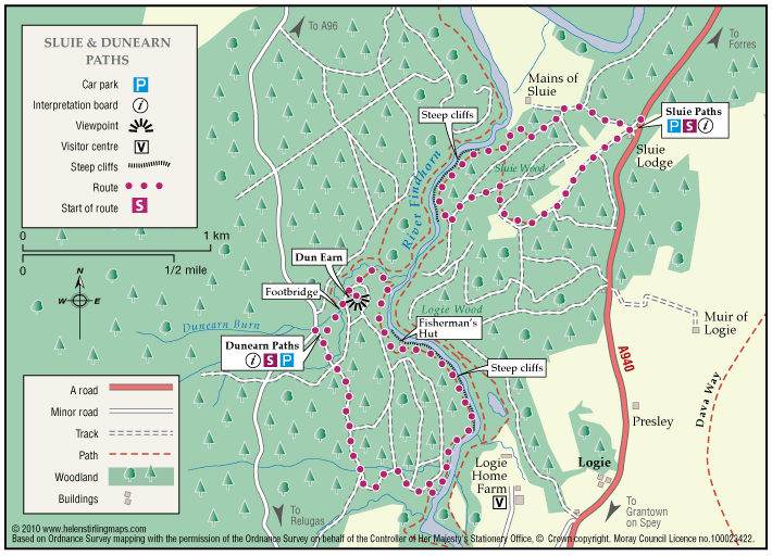
The path is a circular route through woodland, and the sections which follow the river Findhorn are very close to the cliff edge. The path is approximately three miles south of Forres.
- Low Level Walk
- Easy
- 2 miles (3.2 km)
- 1h 30 minutes
- Logie, Sluie
Accessibility: Suitable for a wide range of users
The route is suitable for a wide range of users but the terrain might prove difficult for the less able
Terrain: Forest tracks
Mostly a woodland earth path with narrow aggregate sections, and rough vehicle tracks.
Gradient: Undulating
Be aware the path is undulating and is close to steep cliffs at parts,
- Partly signed