Ben Rinnes

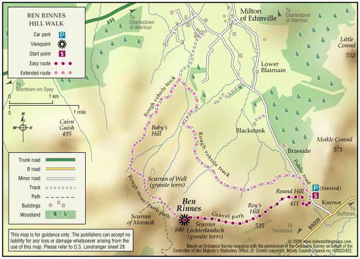
Ben Rinnes is the highest freestanding mountain in Moray at 2733ft (841 metres), and is classified as a ‘Corbett’ – a summit lying between 2500ft and 2999ft. 

  • Unsuitable for wheelchairs and buggies
  • Defined hill path
  • Slopes throughout
  • Unsigned

The Speyside Way

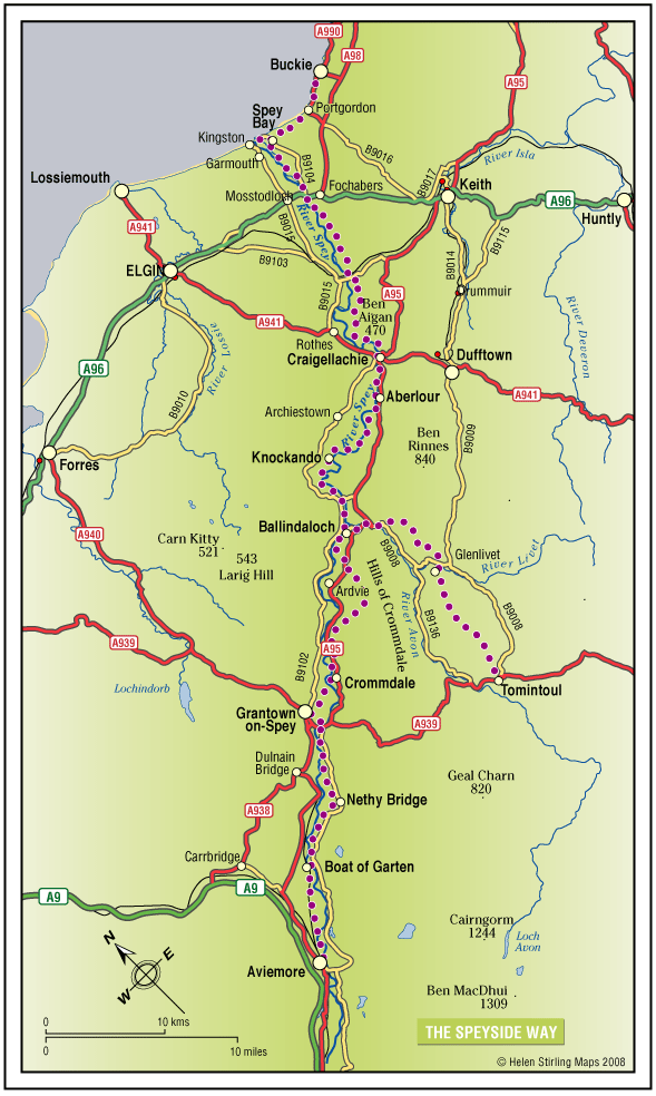
The Speyside Way is one of Scotland’s four official Long Distance Routes (LDRs). It runs between Aviemore, at the heart of Strathspey, 66 miles to Buckie, on the Moray Firth. The route passes through some of Scotland’s most beautiful landscapes; by rivers and mountains, over moorland and along forest paths. It includes a spur to Tomintoul, an additional 15 miles. 

  • Accessibility: Suitable for a wide range of users

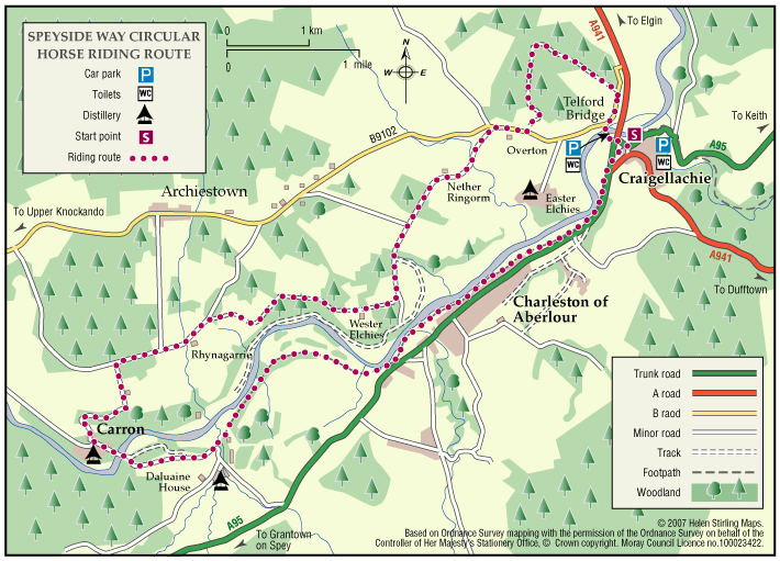
    All of the route suitable for walkers. The route between Fochabers and Ballindalloch and between Nethy Bridge and Aviemore is suitable for cycling. The route is suitable for horseriding between Craigellachie and Ballindalloch.

  • Terrain: Varied surfaces

    The route offers mainly easy walking on low ground (a mixture of seashore, river valley, old railway and moorland). It should be noted that the section between Ballindalloch and Grantown is more strenuous and the Tomintoul Spur is also steeper and passes through very exposed locations.

  • Gradient: Short steep sections

    Most of the route is fairly level with some gentle slopes, although there are some steeper sections between Ballindalloch and Grantown. The Tomintoul Spur climbs to around 1,800ft above sea level at two locations.

  • Many barriers
  • Fully signed