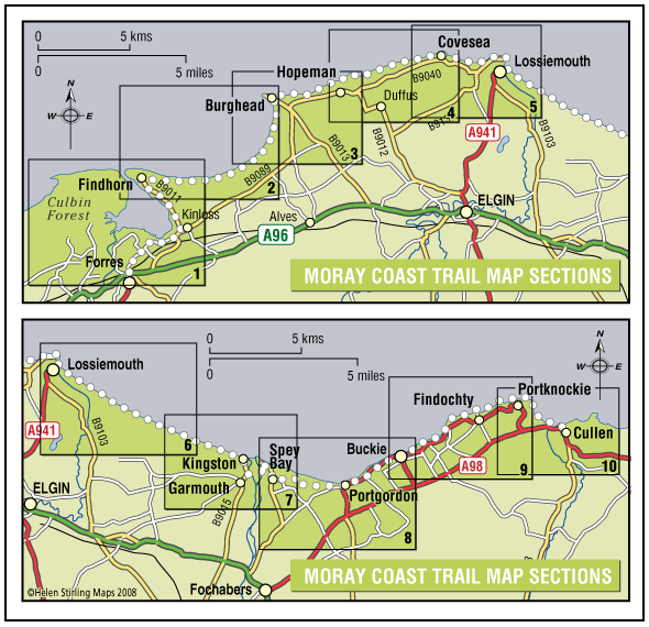
The Moray Coast Trail
The coastline and settlements of Moray are linked by a waymarked coastal trail of approximately 50 miles from Findhorn to Cullen and all the places between. The route can be extended from Findhorn to Forres along a section of cycle route.
- Long Distance Walk
- Challenging
- 50 miles (80 km)
- 24 hour(s)
- Buckie, Burghead, Findhorn, Findochty, Forres, Garmouth, Hopeman, Kingston, Kinloss, Lossiemouth, Portgordon, Portknockie, Spey Bay
Accessibility: Suitable for a wide range of users
Many sections of the route can be used for cycling and horseriding in addition to walking. In wilder locations the path can be steep and rough in places, which would restrict access. Generally the route is most accessible in the vicinity of the coastal settlements. Less able users should concentrate on using these sections.
Terrain: Varied surfaces
There are varied surfaces including tar, gravel and earth paths, with some beach and rock sections. In places the trail follows pavements through the towns and villages, whilst in other areas the route uses rough tracks along the coastal clifftops and forests.
Gradient: Generally level
Generally level with some short steep climbs in places.
- Fully signed

