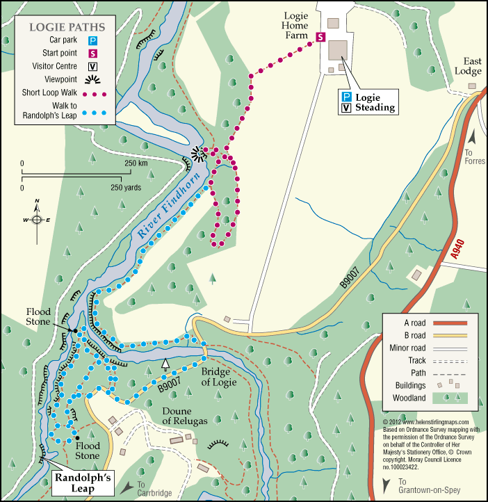
Logie – Dunearn Path
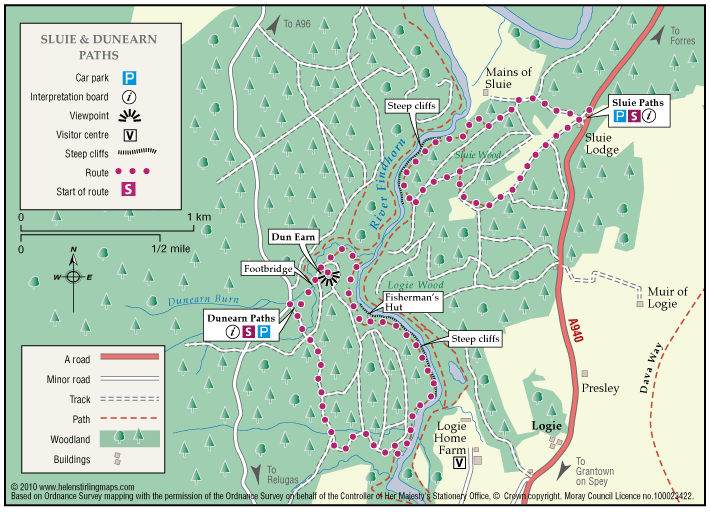
Dunearn path is in the Darnaway Forest and is about one mile south of Conicavel village, it is a circular route, part of which follows close to the River Findhorn. Be aware, the path in sections is very close to the edge of steep drops down to the river.
- Low Level Walk
- Easy
- 2.5 miles (4 km)
- 1h 30 minutes
- Logie
Accessibility: Suitable for a wide range of users
The route is suitable for a wide range of users but the terrain might prove difficult for the less able.
Terrain: Forest tracks
A mixture of woodland earth, aggregate and forest vehicle track. The path can be very wet and muddy in places, in winter time small sections of the path can be covered with leaves so making it very slippy.
- Fully signed