Elgin – Millbuies Country Park
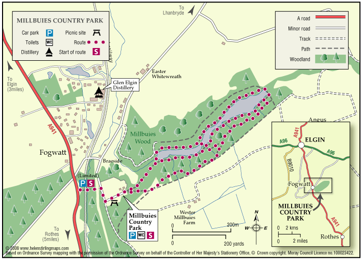
Millbuies Loch was created by the damming of streams to provide angling facilities on the loch.Moray District Council took over the estate in 1975 and the fishing was extended to the public.
- Low Level Walk
- Easy
- 1.75 miles (2.8 km)
- 1 hour(s)
- Elgin, Millbuies
- Unsuitable for wheelchairs and buggies
Terrain: Gravel path
Gravel or soil paths. Sections of the route are not suitable for buggies or wheelchairs.
Gradient: Undulating
Generally level although there is a steep gradient down to the Loch.
- Partly signed