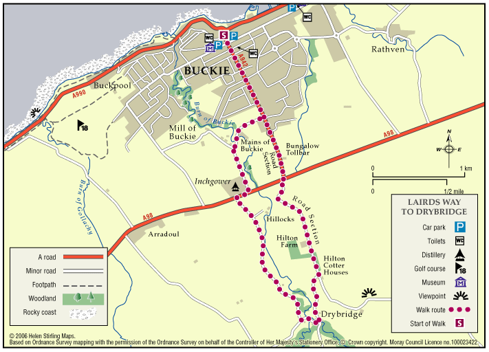
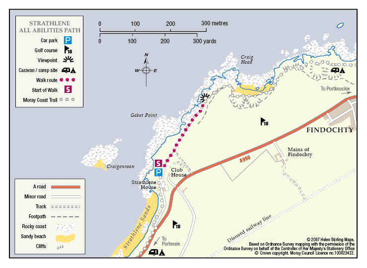
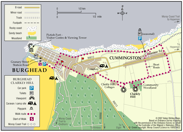
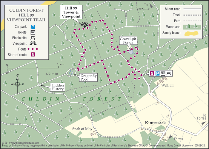
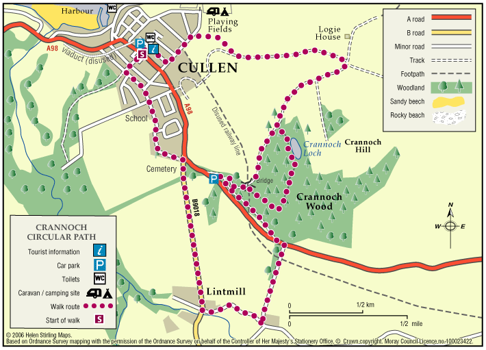
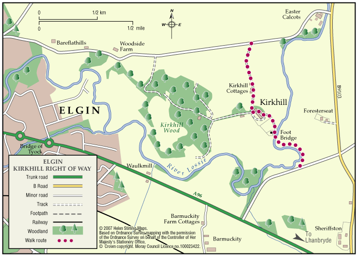
Aberlour – Glenallachie Circular Route
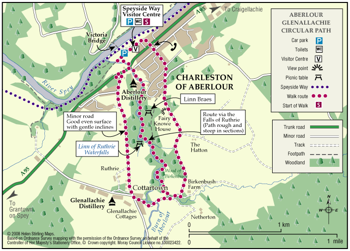
The village of Aberlour is situated in the scenic valley of the Spey. Aberlour has an extensive path network in the surrounding area and is the home of the Speyside Way visitor centre
- Low Level Walk
- Easy
- 3 miles (4.8 km)
- Aberlour