Aberlour – Alice Littler Park

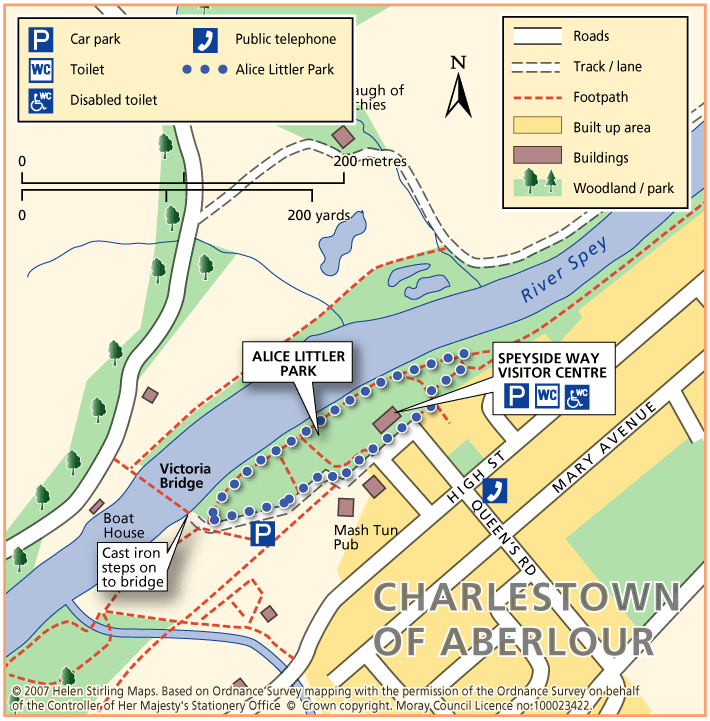
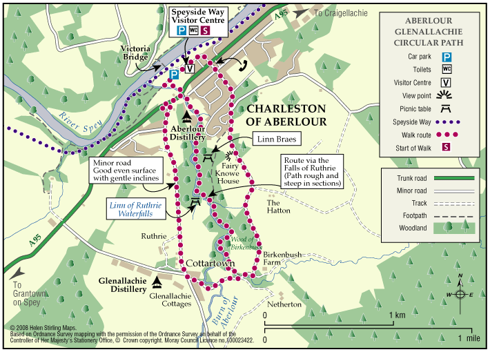
This circular walk round Alice Littler Park is flat and on good paths, making it suitable for wheelchairs and buggies. The path follows the course of the River Spey as it speeds through Aberlour, under the amazing Victoria Bridge. The park itself is full of flower beds and shrubs making this a lovely walk throughout the year. The Speyside Way Visitor Centre is open from March to October and is worth a look in to discover the history and wildlife of the area.

  • Accessible for all users
  • Paved footpaths & roads
  • Generally level
  • Unsigned

Aberlour – River Spey North Bank

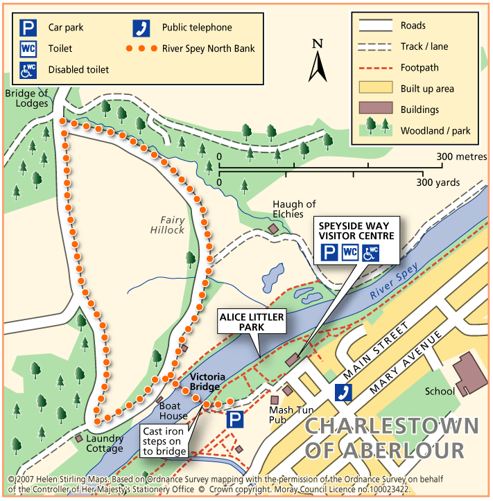
This circular route crosses the River Spey at the Victoria Bridge and follows tracks through beautiful wooded countryside. There are some long moderate inclines. There is a flight of cast iron steps to negotiate getting on to the bridge from the car park, making it unsuitable for wheelchairs and buggies.

  • Accessibility: Accessible for all with care

    May be suitable for wheelchairs and buggies with care if joined from the highest point near 'Bridge of Lodges'

  • Terrain: Varied surfaces

    Estate tracks, short tarred section.

  • Gradient: Mixed gradient

    Long moderately steep incline / decline.

  • Barriers: Some barriers

    Steps onto the bridge.

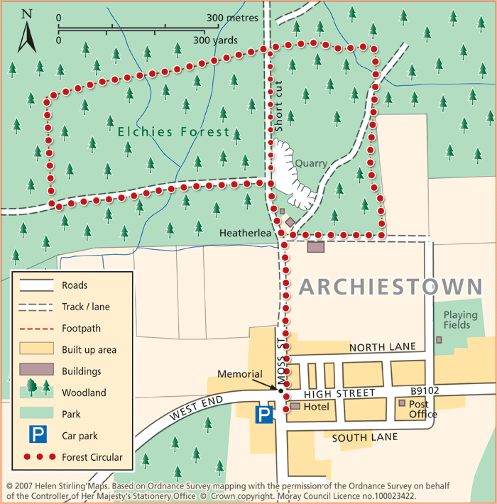
Archiestown – Forest Circular

This circular walk takes you deep into woodland along tracks which are not suitable for wheelchairs and buggies.

  • Unsuitable for wheelchairs and buggies
  • Terrain: Varied surfaces

    A mixture of bare earth and gravel paths. Surfaces can be muddy in places.

  • Gradient: Undulating

    Some steady inclines and declines.

  • Barriers: Some barriers

    Several narrow bridges/ platform bridges. Tree roots in places.

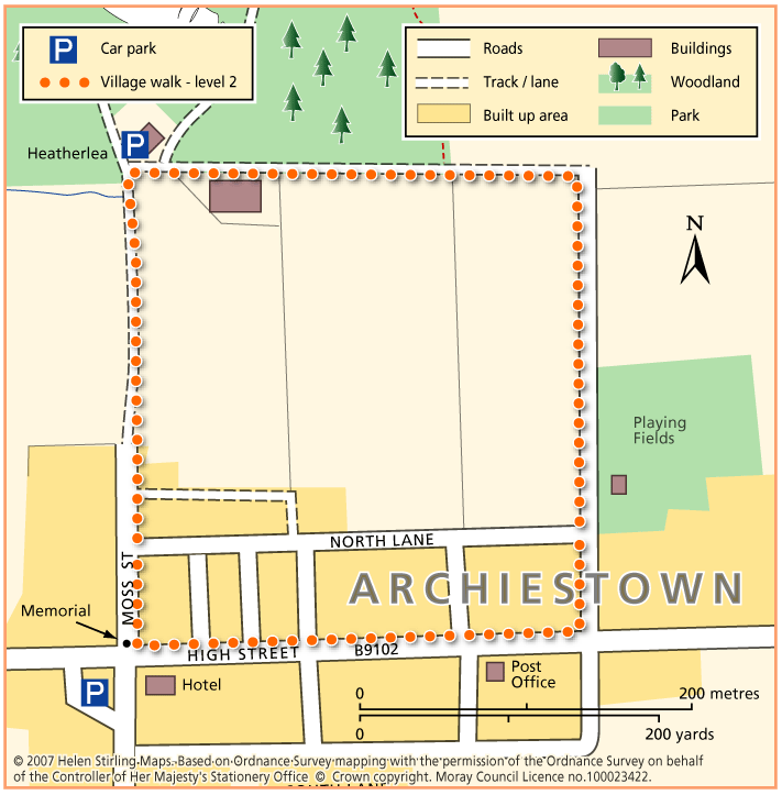
Archiestown – Village Walk

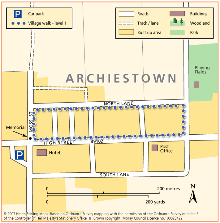
This circular walk round Archiestown includes some dirt tracks and fairly exposed sections which make it unsuitable for wheelchairs and buggies. It gives outstanding views of the surrounding countryside but some parts will be very muddy in wet weather and there are sections with no pavements, so care is needed along the roads.

  • Unsuitable for wheelchairs and buggies
  • Terrain: Varied surfaces

    Mixture of Tarmac paths and gravel tracks. Can be muddy in wet weather. Can also be quite exposed.

  • Gradient: Undulating

    Some gentle inclines and declines.

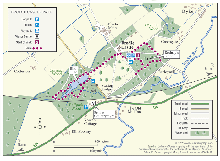
Brodie – Castle Path

Brodie Castle has a variety of paths offering a wide choice of scenic and historic features along the routes.

  • Accessibility: Accessible for all users

    The path around the pond and the woodland paths are suitable for wheelchairs and mobility scooters.

  • Forest tracks
  • Generally level
  • Barriers: Some barriers

    There is a gated single track road crossing between the Castle and the pond walk

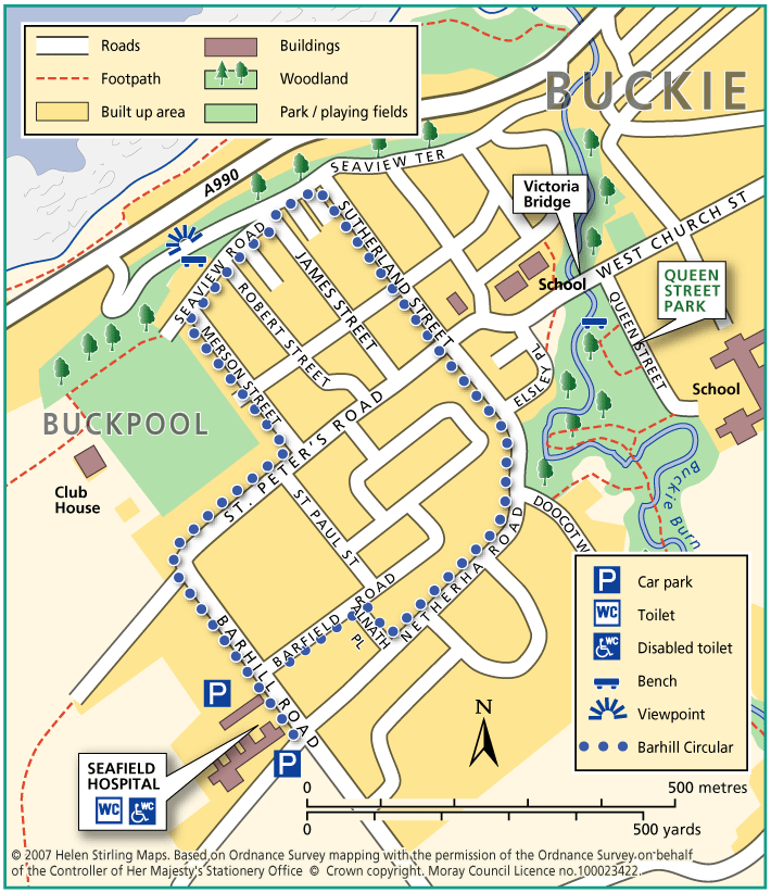
Buckie – Barhill Circular

This is a circular walk along level roads and pavements and is suitable for wheelchairs and buggies. It includes great views from Seafield Hospital and Seaview Road, where there are benches to enjoy the panorama.

  • Accessible for all users
  • Paved footpaths & roads
  • Generally level
  • Partly signed

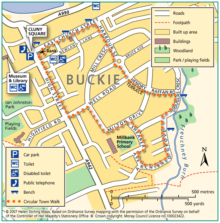
Buckie – Circular Town Walk

Although this circular walk is in town, there are excellent views of countryside and over the Moray Firth, making it an enjoyable walk any time of year. The route is along level paved surfaces and it is suitable for wheelchairs and buggies. There are benches and seats along the route.

  • Accessible for all users
  • Paved footpaths & roads
  • Gradient: Undulating

    Slight hill at Douglas Crescent.

  • Unsigned

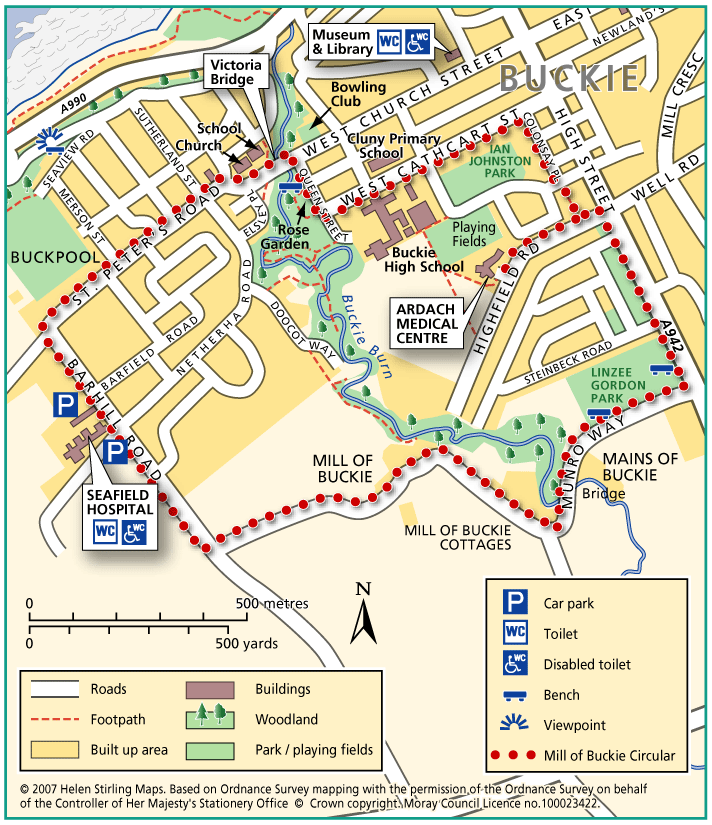
Buckie – Mill of Buckie Circular

This circular walk is along country lanes, tracks and paved streets and is not suitable for wheelchairs or buggies. Parts of the route can be muddy in wet weather.

  • Unsuitable for wheelchairs and buggies
  • Terrain: Varied surfaces

    Tarmac pavements and farm track which can be muddy.

  • Generally level
  • Barriers: Some barriers

    Narrow bridge with steps at Mains of Buckie.

  • Partly signed

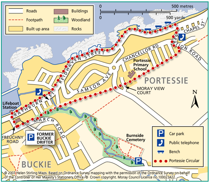
Buckie – Portessie Circular

This circular route starts in east Buckie and includes great coastal views over the Moray Firth. Because the route is very near to the shore for part of the way, it is very exposed to cold, strong winds from the sea. There are benches along the way. The surfaces are good and the only hill is on Station Road, which is fairly steep.

  • Accessible for all with care
  • Terrain: Paved footpaths & roads

    No pavement on Station Road.

  • Gradient: Short steep sections

    Steep slope at Station Road.

  • Barriers: Some barriers

    No drop kerbs on Rathburn Street.

  • Partly signed

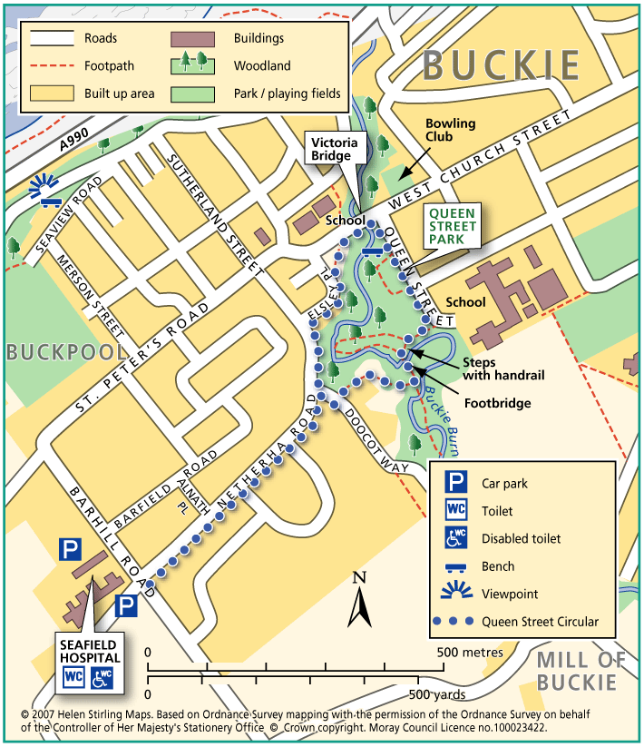
Buckie – Queen Street Circular

Located within the town, this circular walk includes some beautiful open parkland. The route is along paved paths but care needs to be taken at the footbridge, which has steps and a handrail, making it unsuitable for wheelchairs or buggies.

  • Unsuitable for wheelchairs and buggies
  • Paved footpaths & roads
  • Generally level
  • Barriers: Some barriers

    Narrow bridge with steps and handrail in park.

  • Fully signed

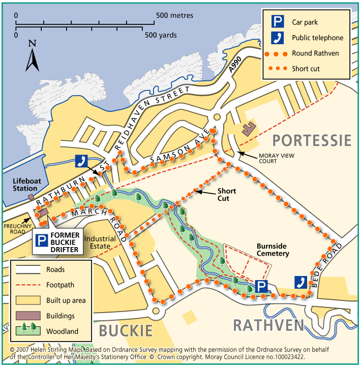
Buckie – Round Rathven

This circular walk has some great coastal views over the Moray Firth and open countryside. The walk can be shortened by cutting along the path opposite Moray View Court.

  • Unsuitable for wheelchairs and buggies
  • Paved footpaths & roads
  • Short steep sections
  • Barriers: Some barriers

    Walking on road in places.

  • Partly signed

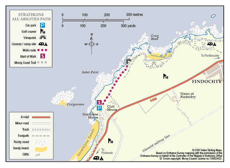
Buckie – Strathlene all abilities path

Located near Buckie, this is a short section of coastal all abilities path, which runs parallel to the rocky foreshore near the old Strathlene lido. There are views to the nearby Craigen Roan rock where seals can be regularly seen and heard. This path forms part of the Moray Coast Trail – Buckie.

  • Accessible for all users
  • Gravel path
  • Generally level
  • Fully signed

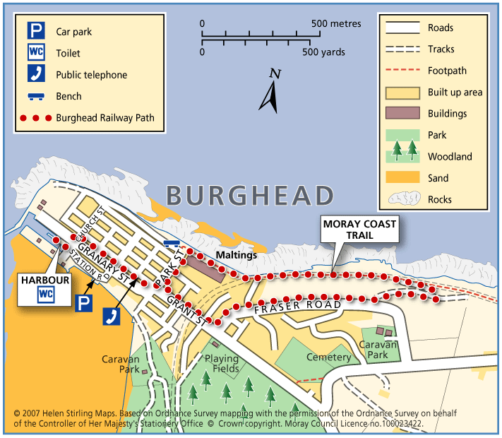
Burghead – Railway Path

This walk takes you from the picturesque harbour in Burghead on a circular route along the old railway track. The surfaces are generally good but not suitable for wheelchairs and buggies. It can be a little exposed if the winds are strong. There are toilets at the harbour and benches on Grant Street.

  • Unsuitable for wheelchairs and buggies
  • Terrain: Varied surfaces

    Gravel paths and tarmac pavements

  • Gradient: Short steep sections

    Fairly steep decline on gravel path between Fraser Road and the coastal path. Elsewhere relatively level with some gentle slopes.

  • Barriers: Some barriers

    Windblown sand can accumulate on a short section of the coastal path, near where it meets the track down from Fraser Road. This may cause difficulties for wheelchairs and some buggies.

  • Partly signed

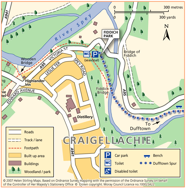
Craigellachie – Dufftown Spur

This is a beautiful, flat, tree – lined sheltered walk along a good path. It is suitable for wheelchairs and buggies with care, although it can be a little muddy in places.

  • Accessibility: Accessible for all with care

    Can be muddy.

  • Terrain: Varied surfaces

    Flat gravel and compacted earth path - can be a little muddy.

  • Generally level
  • Barriers: Some barriers

    Potential Landslides further along path.

  • Unsigned

Craigellachie – Telford Bridge

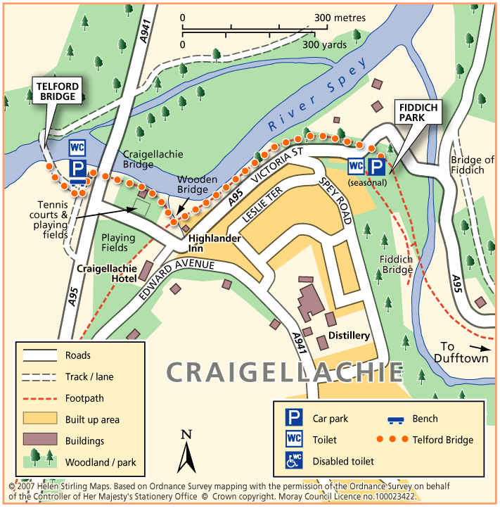
This is a linear walk along level paths, which include grass tracks and so is not suitable for wheelchairs and buggies. It follows part of the Speyside Way and has beautiful riverside views to the famous Thomas Telford metal bridge. There are benches in the car parks at both ends of the walk and seasonal toilets in Fiddich Park.

  • Unsuitable for wheelchairs and buggies
  • Terrain: Varied surfaces

    Compacted earth and gravel paths with some grass sections. Timber bridge. The path also passes under the road bridge.

  • Generally level
  • Partly signed

Culbin Forest- Route 99

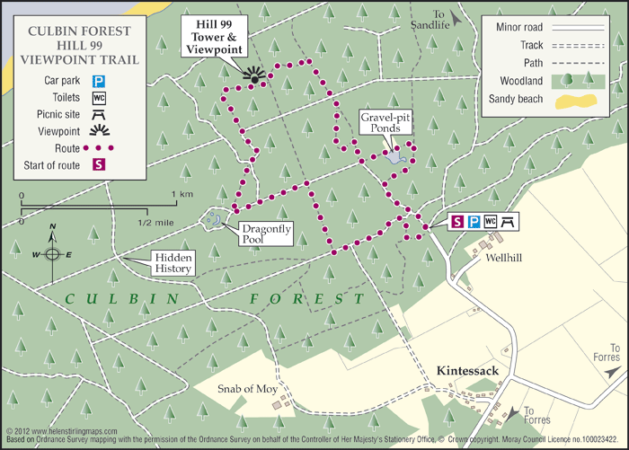
One of Moray’s many Forestry Commissions woodlands with promoted access, it is located on the coastal sand dunes between Findhorn Bay and Nairn. It has a wide network of paths suitable for many users, including the signed all abilities trail, known as the Route 99. 

  • Accessibility: Accessible for all users

    Horse riders are better catered for at the Cloddymoss car park.

  • Generally level
  • Fully signed

Cullen – Crannoch Circular Path

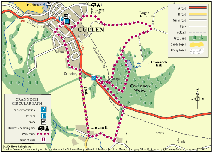
The route provides a variety of views and habitats. Travelling clockwise, the first section east of Cullen provides open views over agricultural land and the coast. The woodland loop provides access to conifer/mixed woodland and freshwater habitats.

  • Suitable for buggies but not wheelchairs
  • Terrain: Varied surfaces

    A mixture of pavements, quiet country roads, and farm tracks, with aggregate and earth paths through the woodland section. These woodland and farm tracks can be muddy in wet weather, and watch out for tree roots within Crannoch Wood. There is a short steep slope at the eastern entrance to the Crannoch Wood circular path, which can be slippy.

  • Gradient: Undulating

    Undulating route with long steady inclines/ declines. One steep section present at the eastern entrance to the Crannoch Wood circular path.

  • Barriers: Some barriers

    Care to be taken when crossing the A98 - this is a very fast and busy road. Several gates leading along the farm track from Cullen to Crannoch Wood.

  • Fully signed

Cullen – Nelson’s Seat

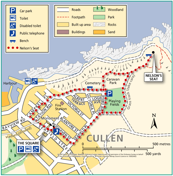
This walk is an extension of the town walk, which includes gravel paths and grass tracks which would make it unsuitable for wheelchairs and buggies. It includes great coastal views over the Moray Firth, with the possibility of dolphin watching.

  • Accessibility: Unsuitable for wheelchairs and buggies

    Unsuitable for wheelchairs and most buggies due to grass section.

  • Terrain: Varied surfaces

    Town Walk section all on tarmac pavements. Gravel footpath and grass.

  • Short steep sections
  • No barriers
  • Fully signed