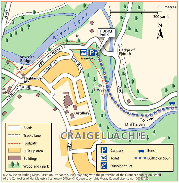
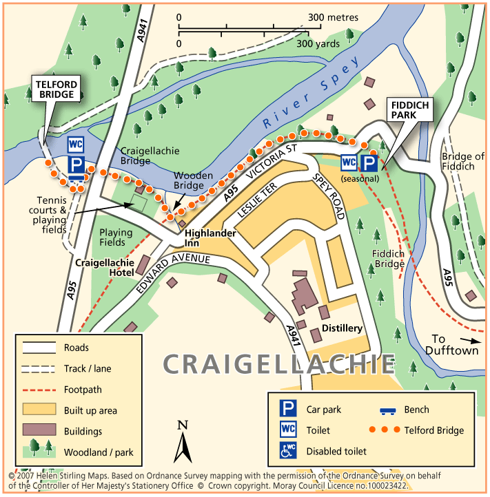
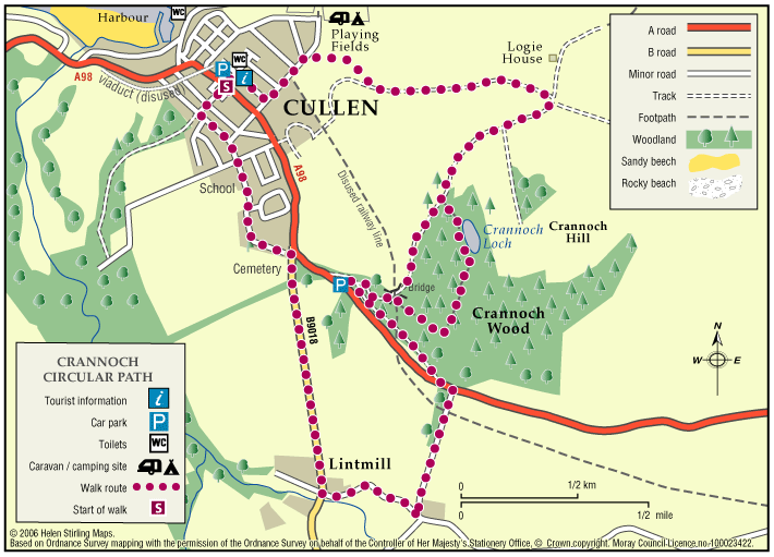
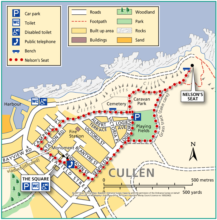
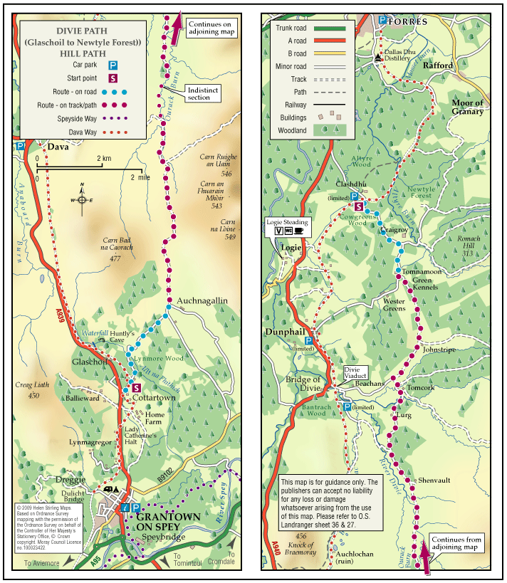
Buckie – Round Rathven
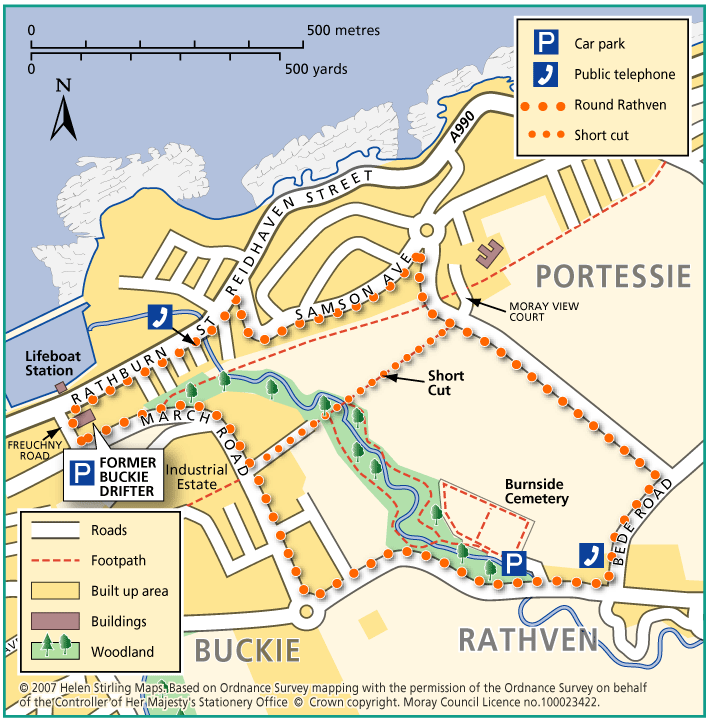
This circular walk has some great coastal views over the Moray Firth and open countryside. The walk can be shortened by cutting along the path opposite Moray View Court.
- Health Walk
- Easy / Level 2
- 2 miles (3.2 km)
- 40 minutes
- Buckie
- Unsuitable for wheelchairs and buggies
- Paved footpaths & roads
- Short steep sections
- Partly signed