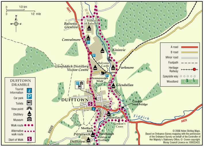
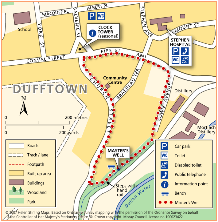
Dufftown – Balvenie Castle
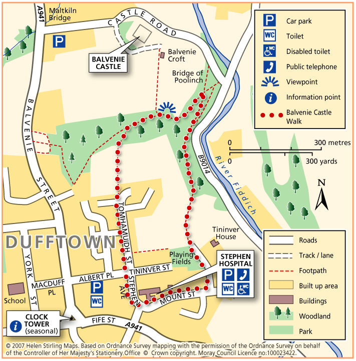
This circular walk has some steep inclines and is not suitable for wheelchairs or buggies because of the terrain. It includes some woodland and has good views of the ruined castle.
- Health Walk
- Easy / Level 3
- 1.25 miles (2 km)
- 30 minutes
- Dufftown
- Unsuitable for wheelchairs and buggies
Terrain: Varied surfaces
Tarmac pavements, compacted earth and gravel tracks. Note that the earth track in the wood is quite narrow and can be muddy/ slippy in wet weather. Watch out for tree roots.
Gradient: Short steep sections
Some steep inclines / declines, with the steepest on a ramped path section within the woodland.
- Partly signed