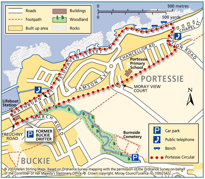
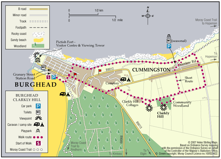
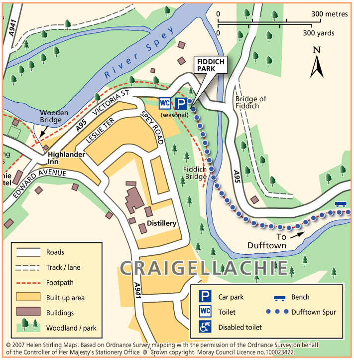
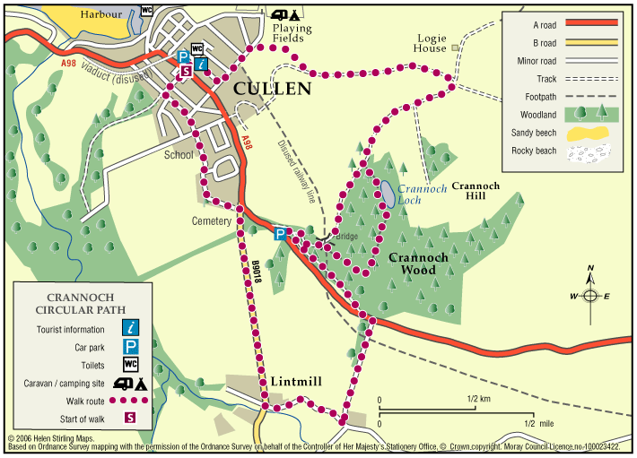
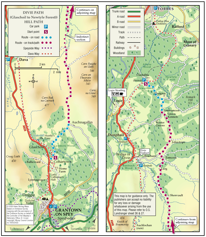
Buckie – Mill of Buckie Circular
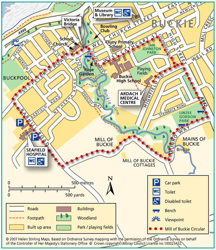
This circular walk is along country lanes, tracks and paved streets and is not suitable for wheelchairs or buggies. Parts of the route can be muddy in wet weather.
- Health Walk
- Easy / Level 3
- 2.5 miles (4 km)
- 50 minutes
- Buckie
- Unsuitable for wheelchairs and buggies
Terrain: Varied surfaces
Tarmac pavements and farm track which can be muddy.
- Generally level
- Partly signed