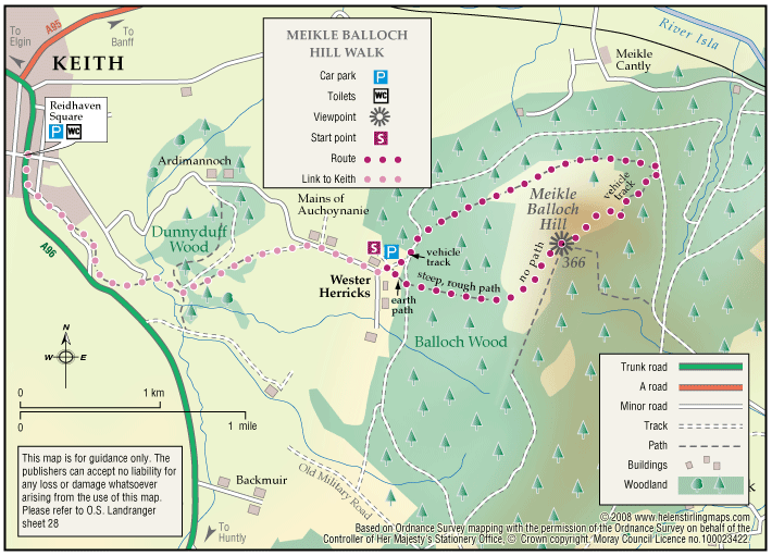
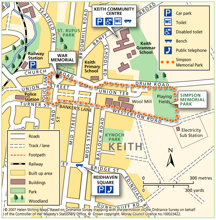
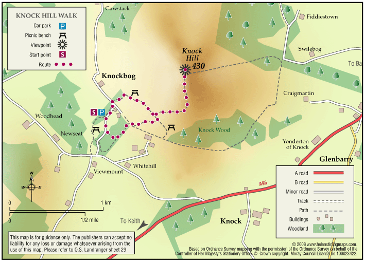
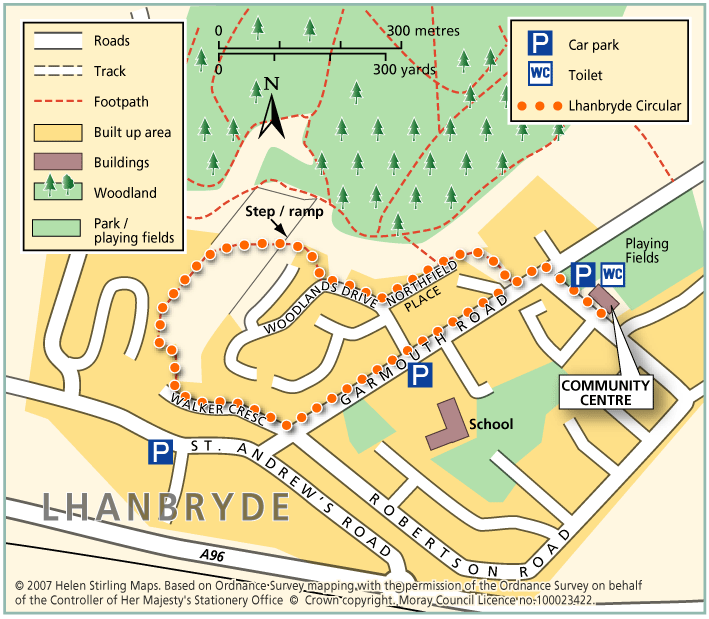
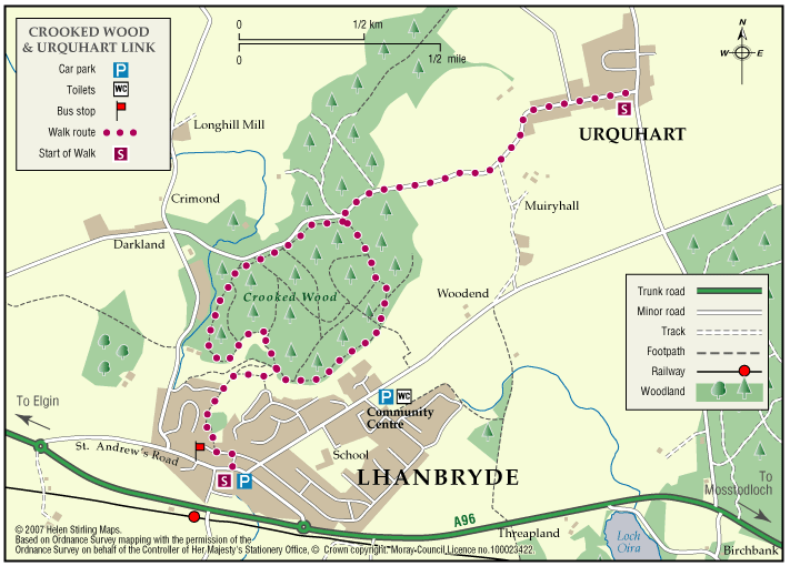
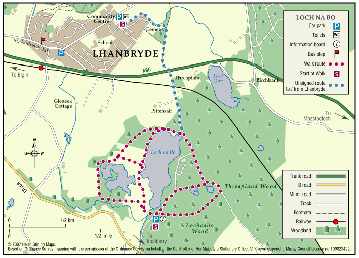
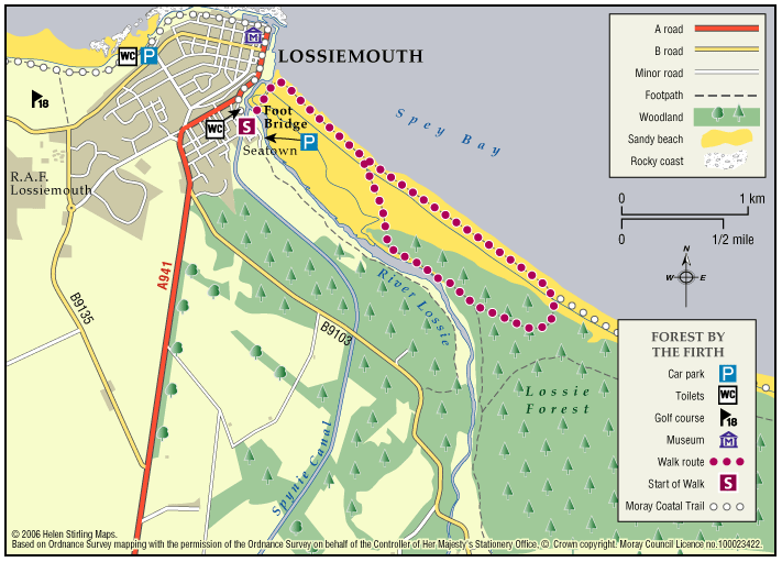
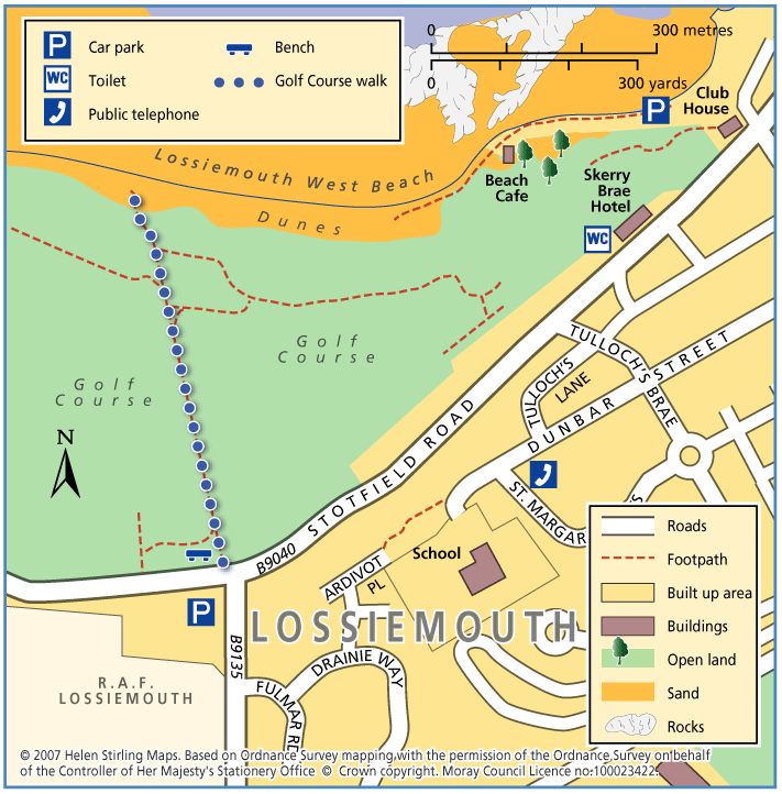
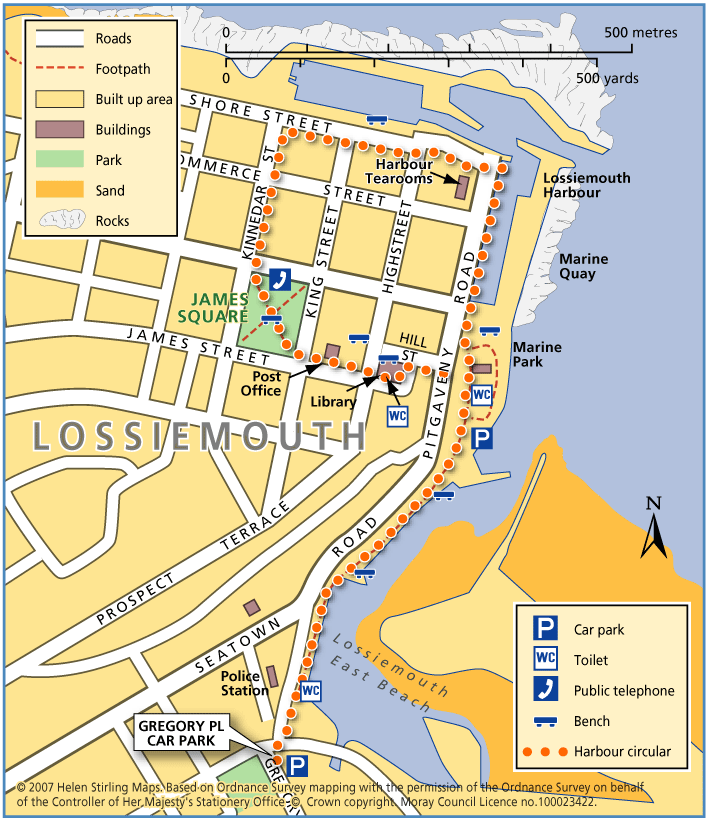
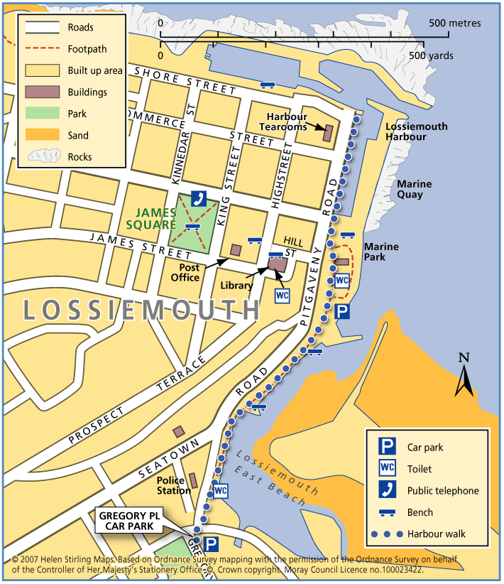
Keith – Kynoch Park Circular
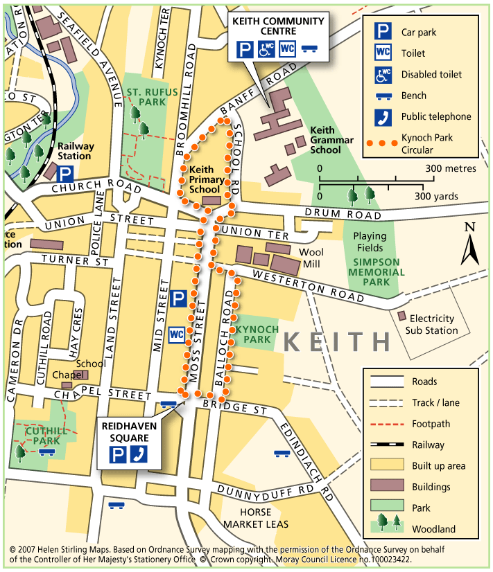
This is a circular walk linking Reidhaven Square to Keith Community Centre. There are benches in the Square and also at the Community Centre. Pavements are good and it is suitable for wheelchairs and buggies. This walk can be added to the Horse Market Circular to make a Level 3 walk of just over 2 miles.
- Accessible Walk, Health Walk
- Easy / Level 2
- 1.25 miles (2 km)
- 30 minutes
- Keith
- Accessible for all users
- Paved footpaths & roads
Gradient: Generally level
Mainly level, but a gentle incline at School Road.